
Search Amherst Streets by Address
A street-by-street search in the Town of Amherst starts with the parcel, not with a claim about who is inside a property. Amherst assessment tools can connect a street number and partial street name to a situs address, current owner or owner mailing line, and section-block-lot number. Erie County GIS then supplies the Amherst parcel shape and nearby street context. From there, an Amherst owner name, deed reference, or SBL can move the search into recorded land records. Older Amherst reverse directories add a dated household clue, rather than a present-day answer. This sequence keeps title, mailing, occupancy, and map evidence separate.
- Search the address in the Town of Amherst CPI portal. Record the situs address, SBL, owner spelling, mailing address, assessment date, and any deed book or page reference.
- Locate the same Amherst parcel in Erie County GIS. Confirm the municipality and compare the parcel with the street, ZIP, district, and environmental layers that matter to the question.
- Use the Amherst SBL, parcel reference, or party name in BrowserView. The County Clerk does not provide a land-record search by street address.
- For a lawful Amherst street-level election question, use the Erie County Board of Elections request route. The single-record state voter lookup is not a public street browser.
- For a historical Amherst household lead, check the reverse or suburban directory run nearest the date, then test it against a deed, tax roll, census, or newspaper item.
Note: A chain of dated records is stronger than a single owner, mailing, or directory entry.
Search Fields for Amherst Streets
The Town of Amherst Comprehensive Property Information search was relaunched after the prior GAR Associates system ended in June 2024. It supports a short Amherst street search rather than a rigid postal string. The Amherst instructions use 223 and N Forest as the model, so a street type is not required. A last-name search can be partial, and the SBL supplies the best bridge when an Amherst street label has changed or a parcel has been divided. Amherst BAS offers a second municipal route with separate address, owner/business, and SBL controls.
| Amherst search field | How to use it | Useful result |
|---|---|---|
| Street Number | Use alone or with an Amherst street name. | Starts an Amherst address-keyed parcel search. |
| Street Name | Enter a partial Amherst name; omit the street type when needed. | Finds a street even when the full postal form varies. |
| SBL / Section Block Lot | Enter the Amherst parcel key, such as 68.20-9-47. | Crosswalks Amherst assessment, GIS, and deed research. |
| Owner Last Name | Use a full or partial surname; first name is optional. | Finds an Amherst parcel when the street address is incomplete. |
| BAS Street or Owner/Business | Use the separate Amherst BAS address or general text controls. | Opens Amherst municipal parcel and transaction routes. |
These searches show assessment and parcel information. A result with an owner mailing address does not establish that the owner lives at the Amherst parcel, and a situs address does not name every person there.
Map an Amherst Street Segment
The Erie County GIS parcel viewer is the map step in an Amherst by-address search. Find an Amherst address, owner, or SBL, select the parcel, and inspect the context around it. Its documented layers include parcels, streets, ZIP codes, school and legislative districts, water, wetlands, flood areas, agricultural districts, and soils. The viewer can identify an Amherst parcel and offers documented query, export, and map-output tools. It is useful for locating an Amherst street segment, but it is not a legal survey and its coordinates are not legal parcel corners.
Use the map to record nearby Amherst parcel keys and municipal context, then return to CPI for assessment data and BrowserView for a recorded instrument. That order prevents an Amherst map polygon from being mistaken for a deed or a household list.
Erie County’s public parcel viewer shows the GIS layer controls and parcel-search environment used for this Amherst address route.
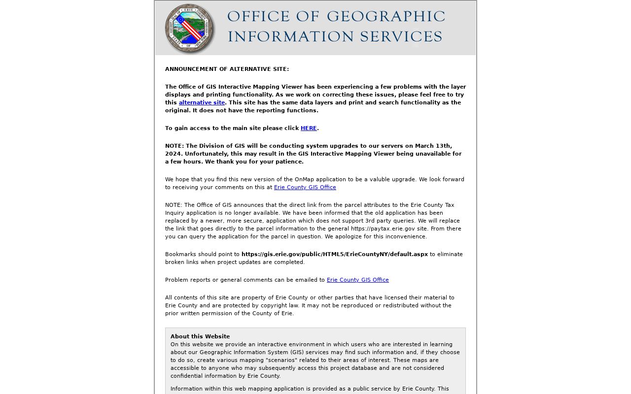
A selected parcel provides map context only. Confirm its SBL, current assessment information, and recorded title separately before using it as an address-history lead.
Amherst Street Records by Parcel
The records below are keyed differently, which is why a complete Amherst address-record search changes keys as it proceeds. CPI and the annual assessment roll begin with an address or SBL. GIS begins with map geometry. BrowserView uses a party, parcel or map number, document type, town, and date range. A permit record may be tied to an address or transaction. The voter-file route is a request for a defined scope, not a universal online street list. Keeping the access method beside each record avoids an overbroad street result.
| Address record | Amherst street use | Access and limit |
|---|---|---|
| Amherst CPI property card and final roll | Current owner, mailing line, values, class, exemptions, SBL, and physical fields. | Free Amherst search and dated roll; owner and occupant are not interchangeable. |
| Erie County GIS | Amherst parcel geometry, street, ZIP, district, and nearby features. | Free viewer; Amherst data are as-is and not a survey. |
| Erie County Clerk deed index | Amherst recorded parties, document type, date, book/page, instrument, and legal description. | Free index from 1986 for land records; the Amherst street address is not the index key. |
| Amherst BAS and Building Department | Amherst address-linked transaction, application, permit, or right-of-way lead. | Public Amherst lookup exists; historic coverage was not stated. |
| Erie BOE voter-file request | Permitted Amherst registration fields in a chosen Town, Ward, or District scope. | Written request, fees, use limits, and protected Amherst records apply. |
| Amherst reverse directories | Historical Amherst address-to-occupant clue for an available publication year. | Coverage is uneven; an omission is not proof of absence. |
A parcel’s legal description and SBL are more stable than a mailing label. That distinction matters in Amherst, where Williamsville, East Amherst, Getzville, and other postal names can cross the Town boundary.
Trace Amherst Street Deeds
The Erie County Clerk BrowserView index is the recorded-title step. Search a party as Last-Name First-Name without a comma, or use a parcel or map number where available. Add Town of Amherst, a document type, and a recording-date range to narrow a result. BrowserView can show the party, document type, recording date, book/page or instrument number, and verification status. The index is free, while image viewing remains subject to registered-user or Clerk-office conditions.
For one address, take the latest owner or deed reference from CPI, find the latest transfer, and read the grantor, grantee, legal description, and any prior instrument reference. Search the seller as an earlier buyer, then compare the legal description at every turn. Do not use a mortgage, lien, or map image as a substitute for the transfer deed. Online land-index coverage begins in 1986 even though the Clerk’s deed series reaches back to 1808.
- Parcel
- A mapped unit of taxable land. Its SBL helps match the assessment record, GIS context, and recorded land trail.
- Situs address
- The physical parcel location used for assessment and mapping. It is different from a mailing address and from a complete occupant list.
- Legal description
- The recorded lot, subdivision, or metes-and-bounds description that carries a parcel across older deed and address changes.
- Criss-cross directory
- A reverse directory section that begins with a street address and can list an occupant or household for a particular publication year.
Read Older Amherst Streets in Reverse
Historical street work needs a publication sequence, not a modern people list. Erie County Suburban appears for 1949, Buffalo Northeast Suburban has runs for 1957, 1958, 1960–64, and 1966–80, and Buffalo Suburban begins in 1983. Check the heading for Amherst, Williamsville, Eggertsville, or Snyder before treating an entry as a Town of Amherst address. The Buffalo & Erie County Public Library and Buffalo History Museum keep the collection layer; the historical volumes themselves are covered on the Amherst city directory page.
Reverse sections begin with a street address and can point to a dated household. They do not prove ownership, and older publications can omit people or contain gaps. Pair a reverse listing with an assessment roll, deed chain, census, Amherst Bee notice, or tax roll according to the period in question.
Erie County GIS map help documents the address, owner, SBL, query, export, and map-output tools that can help connect a historic street string to current parcel geography.
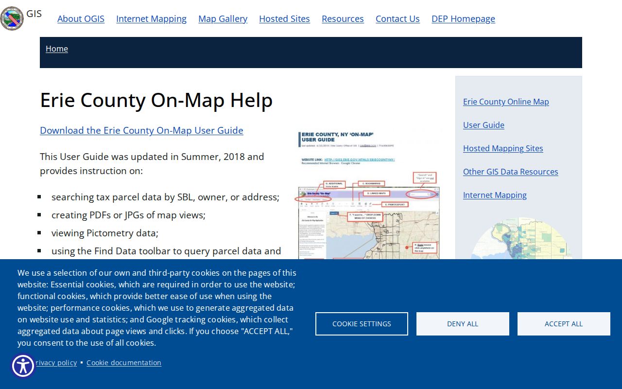
When the current street name fails, compare the legal description, old directory heading, historic-map evidence, BNHV subject files, and the GIS street layer instead of assuming a Town-wide renumbering event.
Amherst’s 546-Page Assessment Roll
The 2024 final roll is a 546-page, dated snapshot that shows why Amherst address research must read field labels closely. Representative rows include a situs address, SBL, property class, owner name, mailing address, land and total values, taxing-unit columns, special districts, dimensions, exemptions, and sometimes a deed book/page. A Williamsville PO box beside a parcel is a correspondence field, not a statement that a person resides at the parcel. A commercial or nonprofit class can also appear beside a street address, so the class field matters before a result is described.
The 2024 Town of Amherst final assessment roll is the source for this numeric snapshot and the field-level examples.
This roll preserves a useful history point, but it is not a live residency record. Check CPI for the current parcel view and keep the roll date beside any observation.
Amherst Street Permits and Code Files
The Amherst BAS parcel and permit portal adds a municipal address route to a by-street record search. Its landing controls include Lookup Parcel or Location, Go To Transaction, Submit a Request, Submit an Application, and Help. The address lookup has Street #, Street, and a general Owner/Business field, while SBL is a separate lookup. A right-of-way area search by street name can cover public assets such as streets, sidewalks, traffic lights, curbs, storm drains, and utility poles.
The portal does not state a complete historic permit cutoff. A blank response does not establish that no work, inspection, complaint, or permit record exists. Contact the Building Department or make a Town of Amherst FOIL request for an identifiable record when the portal cannot answer the date question.
Amherst BAS provides the municipal parcel and transaction interface used for an address-level permit lead.
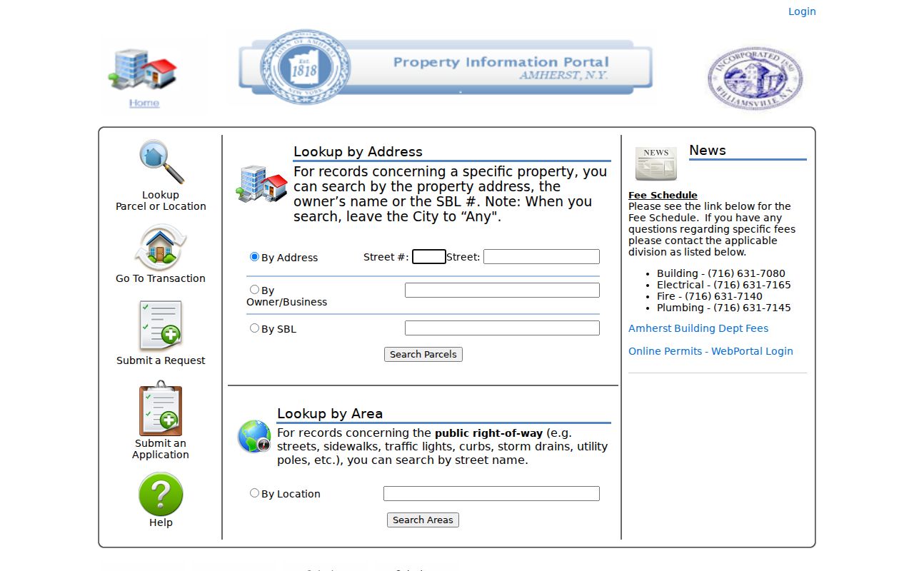
Permit and code evidence can date work or an application at a parcel. It does not by itself identify every past or present household.
Amherst Street Voter File Route
New York Election Law §5-602 allows annual voter lists to be inspected and arranged by election district, street and number, or alphabetically. Amherst users who need the lawful street-level route should use the Erie County Board of Elections voter-file request form, which offers Town, Ward, and District scope; address or name sorting; party selection; and paper, spreadsheet, or database formats. A CD begins at $25, paper copies are 25 cents per page, and the form says many requests are maintained for up to five business days, with other requests taking longer.
The statewide NYS Voter Registration Lookup is different. It is a one-record confirmation form using county, name, date of birth, and ZIP information, not an online Amherst street roster. Confidential registrations under Election Law §5-508 and Address Confidentiality Program records remain outside an ordinary public-address result.
Note: A voter-file request must follow the Board’s field choices, payment instructions, use acknowledgment, and protected-record rules.
Limits of an Amherst Street Directory
Amherst address research can connect records, but it cannot supply a complete list of occupants. Assessment records identify taxable parcels and owners. Deeds document recorded title events. GIS maps parcels. Directories provide dated printed clues. Utility customer lists, private delivery records, and DMV address data are not public resident directories, and the federal Driver’s Privacy Protection Act limits DMV disclosure. A school-zone result identifies an administrative area, not children or households.
New York Freedom of Information Law, Public Officers Law Article 6 §§84–90, opens agency records unless an exemption applies. It does not override sealed court material, vital-record rules, confidential voter registration, or Address Confidentiality Program protections. A blank search can reflect a protection, a date cutoff, a changed street string, or an office-only record.
Lawful use. Use Amherst address records for personal, lawful research such as family history, property curiosity, estate work, or civic transparency. Do not use a name or address to stalk, harass, or harm anyone.
Amherst Street Search Fallbacks
When an online search stops, use the record-specific fallback. Erie County Clerk land searches provide index data, but public-access terminals can show images under the Clerk’s rules. Older deeds may require a book/page or older-index route. Mail requests should include the owner name, property address, approximate date, book/page when known, contact information, and a self-addressed stamped envelope. The Clerk lists a $5 certified copy in person and a $10 mail charge that includes a $5 search fee.
For older local context, Buffalo Niagara Heritage Village has Amherst Bee microfilm from 1879–2012, tax rolls from 1854–1900, directories, indexes, and subject files by appointment. The Town Clerk and FOIL intake are the municipal route for an identifiable Town-held record not available online.
Erie County Clerk request rules explain the office and mail routes used when the online address trail is incomplete.
A missing portal result often marks an access boundary, not a missing Amherst history. Preserve the date searched and ask the custodian for the next available channel.